Strong El Niño – Floods for California
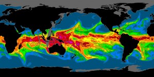
By Michael FaginFlooding, General InfoWith 0 comments An atmospheric river flowing into California. Image courtesy of NOAA
Strong El Niño – Floods for California: are they correlated? El Niño can impact California greatly but it does not promise flooding, nor rain. It instead promises a shifting of the region’s atmospheric currents.
Strong El Niños (1.5°C or more of warming), however, are strong indications of extra rain. 4 out of 5 of the most recent strong El Niño events brought substantially heavier precipitation, especially to southern California. Weak to moderate events have little effect on precipitation totals.
Currents laden with tropical moisture called atmospheric rivers are slightly more likely to dump weeklong rains that instigate flooding when there is no El Niño. Severity of flood damage is most directly related to proximity to an atmospheric river. Most of the annual damage occurs during the winter. A table of California’s costliest years due to flood damage can be found here.
Historically, there has been great confusion when discussing El Niño because the term has meant two very different things. The term El Niño was first used long ago along coastal Peru to define a warming of the southern-flowing local current. The thermal change can be a result of a myriad of factors but often coincides with a cyclical, prolonged, significant warming of the Pacific that stretches eastward – the nearly completely distinct, modern definition of El Niño.
Many intellectual centers of the world define El Niño using different parameters but NOAA defines it as 0.5°C (0.9°F) of warming in the east-central Pacific for at least three months. El Niño is a phase of the El Niño/Southern Oscillation: a natural, cyclical, vaguely-understood thermal pattern of the surface waters of the east-central Pacific and surface pressures over the western Pacific. The opposite of El Niño, the colder phase with lower pressures in the western Pacific, is called La Niña.
The current El Niño event is of moderate strength (1.0°C – 1.4°C) and the atmosphere is showing all of the signs that indicate additional warming will occur in the near-term. The Climate Prediction Center’s current El Niño/Southern Oscillation Diagnostic Discussion documents July temperatures in the central Pacific as +1.0°C and over +2.0°C in the eastern Pacific. It predicts that the event will peak around December and suggests an 85% chance of it lasting until spring 2016.
Written by Meteorologist Geoff Linsley
Thanks to Meteorologist Jan Null for some of the links
