Hail: Forecasting the Threat
By Michael FaginGeneral Info, Turbulence, Weather ConditionsWith 0 commentsHail is best detected by radar, which shoots radiation in all directions and measures the density of the beams that the nearby environment reflects back. Areas of higher reflectivity indicate more atmospheric content, which indicates the storm cell observed is likely close to maturation. This means it has a speedy, tall updraft and copious ambient supercooled (below freezing) water droplets and ice particles – all of which are necessary for the formation of hail. A special kind of radar called a polarization diversity radar can vaguely measure the presence of hail but it can be easily confused with extreme rainfalls.
Mature storm cells often develop a radar phenomenon that’s known as a hook echo because of its shape. The empty component of the hook, called a Bounded Weak Echo Region, indicates the location of a cell’s updraft. This is where ice particles are cast and recast many times over high into the sky until descending all around the updraft as hail, especially toward the net flow of the storm cell. Ice particles that are cast upward in the stronger regions of the updraft will likely move too fast for meaningful hail formation. Sideways trajectories near the updraft are much more efficient for the accretion of supercooled water droplets and the deposition of both ice particles and other hailstones.
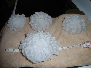
Between 1-2% of US crops are destroyed by hail and 25% of them are covered by hail insurance. Structural and agricultural damage equally amount to around $1.5 billion in the US annually. Higher wind speeds throw hailstones faster, causing more damage. If allowed to grow to two inches in diameter, they can crack windshields. Most of the threat of hail in the US is in “Hail Alley,” which most prominently includes Southeastern Wyoming, Western Nebraska and Northeastern Colorado, but also extends to Dallas. The NWS does not specifically forecast for hail but the threat may be announced during Severe Thunderstorm Watches and Warnings. Photo below: Giant hailstones collected by Les Scott. Image credit: NOAA.gov
Written by: Meteorologist Geoff Linsley