Frontal Squall Lines
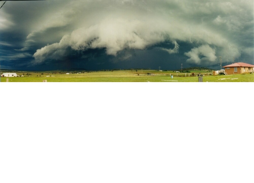
By Michael FaginGeneral Info, Poor Visibility, Turbulence, Weather ConditionsComments are offFrontal squall lines form just ahead of surface cold fronts and dry lines, and also ahead of upper-level fronts. If the necessary conditions exist, they may stretch to hundreds of miles in length. They may bring tornadoes and hail but they’re more commonly associated with strong straight-line winds. If the flow along a squall line shifts parallel to the line and the line is partially or completely inhibited from advancing – a sinking phenomenon called “training” – flash flooding can become a concern. Frontal squall lines develop rain-cooled gust fronts, which may push moisture upward downstream and create parallel squall lines. Photo below is an encroaching frontal squall line, NOAA photo credit.
Article written by Meteorologist Geoff Linsley